Flash flood watch for eastern and southern parishes
Article By: Old Harbour News
-

- Jan 04, 2026 02:12 PM | News
-

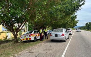
The watch covers low-lying and flood-prone areas of St. Mary, Portland, St. Thomas, Kingston, St. Andrew, St. Catherine, Clarendon, and Manchester.
The alert comes as a broad Trough across the central Caribbean continues to drive unstable weather across Jamaica. Since last night, satellite imagery and rainfall gauges have confirmed moderate to heavy showers and thunderstorms, particularly affecting the warned parishes.
"The activity is forecast to continue this morning," the Met Service stated, "while spreading across the rest of the island this afternoon and evening." Residents islandwide should prepare for wet conditions, with lingering showers expected across most parishes on Monday.
The unstable weather extends beyond land. The Met Service has warned that sea conditions will deteriorate near showers and thunderstorms. Fishers and marine interests, especially those operating inshore and offshore along the south coast, are strongly advised to exercise extreme caution.
A Flash Flood Watch indicates that conditions are favourable for rapid flooding to develop. Residents in the listed parishes should:
- Take precautionary measures now. Secure important items, clear drains and gutters where safe to do so, and avoid walking or driving through flood waters.
- Keep informed by monitoring official updates from the Meteorological Service.
- Be ready for quick action if flooding is observed in their area or if the watch is upgraded to a Flash Flood Warning.
"The Meteorological Service will continue to monitor this system," the release concluded, underscoring the evolving nature of the situation.
For the latest official updates, the public is encouraged to call the emergency information line at 116 or visit the Meteorological Service website: http://metservice.gov.jm.
Residents are urged to take this watch seriously and prepare for potentially hazardous weather conditions throughout the day and into tomorrow.


, nominated commissioner, receives his instrument of appointment from chairman of the Electoral Commission of Jamaica (ECJ), Earl Jarrett at the office of the ECJ on Wednesday, February 4, 2026.")